The first annual consultation on bathymetric data is over
In September 2022, Blue Cluster published recommendations on the planning, gathering and sharing of bathymetric survey data. The document containing recommendations was drawn up in partnership with VLIZ and the Agency Maritime Services and Coast (MDK) following a series of workshops with the actors involved in the collection and exploration of bathymetric data in the Belgian part of the North Sea.
One of the recommendations is the organisation of an annual consultation between these actors. This consultation should serve as a forum for exchanging experiences and insights into the surveys conducted or planned. On this basis, the established procedures and standards can be adjusted.
The first consultation took place on 22 November 2022, bringing together some 20 actors from the government, industry and research. This was the beginning of a structural dialogue aimed at the effective sharing of bathymetric data. This initiative is a good example of how public and private parties can work more closely together in the field of data management.
Creating a win-win situation
During the consultation, examples were mentioned of how survey plans have been adjusted this year. For instance, MDK cancelled the planned survey of the Princess Elisabeth Zone and Paardenmarkt when it turned out that the FPS Economy and the FPS Environment had already surveyed these areas. The surveys are governed by a structured planning and serve to ensure the safety of shipping.
Numerous surveys also take place within the scope of projects for which only specific zones are important. For the Coastbusters project, VLIZ mapped the bathymetry of the test zone off the coast of De Panne. For research into alternative sand sources for the SUSANA project, for instance, the Royal Belgian Institute of Natural Sciences (RBINS) has planned additional charting work.
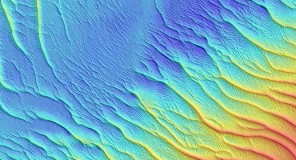
This gives rise to a whole series of bathymetric data sets, with certain zones being surveyed very frequently (e.g. acoustic reference zone and twin area) and for which time series are available.
Demo with EMODnet
Flemish Hydrography’s bathymetric database now contains over 34,000 surveys (dating from 1990 up to the present). These data sets can now be downloaded via the web portal, but in the future it will be possible for third parties to add data sets themselves.
To be able to share data as much as possible, two procedures have been developed and demonstrated. The first option enables users to directly add data to the EMODnet portal in 6 steps. In the second option, MDK takes care of the management and quality control of the data and the input of the metadata in the EMODnet portal.
Every data owner can decide for themself which option he/she prefers and whether permission is required to release the data. It is essential that it is made clear as far as possible what data are already available.